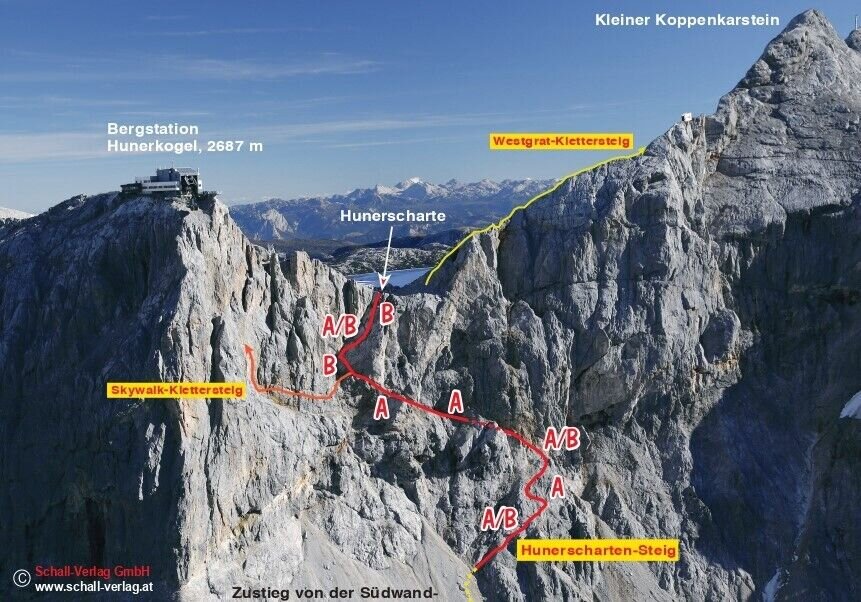
contact
contact
Ramsau am Dachstein

Hunerscharte

Tour description

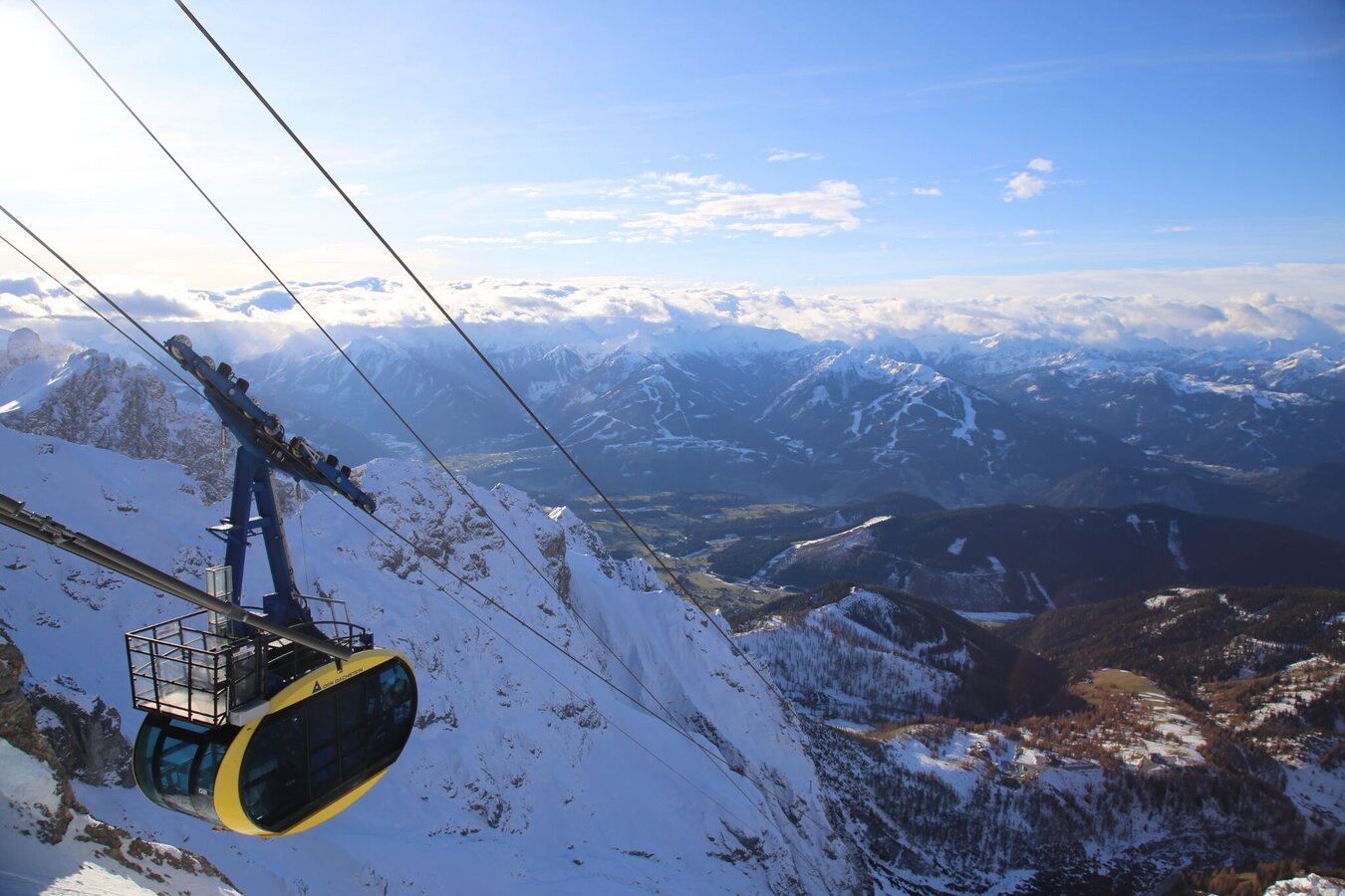
The climb up to the Hunerscharte is a well-known way to reach Dachstein glacier from the south, with permanent safety features for the final 200 vertical meters. For mountaineers in good condition, it leads directly to the Sky Walk Klettersteig, though is also a very attractive way to reach the Koppenkarstein Westgrat Klettersteig.

Times:

  • Via Ferrata - 0:45 h
  • Time to Base - 2:30 h
  • Time from Top - 0:30 h and gondola ride down
  • Total - 3:45 h

The tour

B
Tour characteristics
Exposition:
Distance: 500 m Climbing time: 45 min
Information
Elevation at the starting point: 1700 m
Hiking time to the starting point: 2 h 30 min
Elevation at the entrance: 2410 m
Elevation gain on the via ferrata: 200 m
Elevation at the exit: 2610 m
Walking time (descent): 30 min
highest point: 2687 m
Best season
Jan
Feb
Mar
Apr
May
Jun
Jul
Aug
Sep
Oct
Nov
Dec

Map, elevation profile & further information

From the valley station of the Dachstein Glacier Cable Car, take the marked hiking trail to the Dachstein South Face Hut. Shortly before the hut, turn right and follow the alpine trail #615 into the scree cirque "Schwadrinn," then continue uphill, somewhat more strenuously, to the start of the safety equipment.
From the via ferrata starting at the Austriascharte ridge, head north before the rope bridge to the large ladder leading to the Rosmarie tunnel. Descend to the Schladming Glacier and return to the Hunerkogel via the groomed trail, or follow the approach from Hunerscharte to the Hunerkogel as per the ascent.

Arriving from the west: From the west you can take the Munich-Salzburg motorway, continuing on the Tauern motorway (A 10) until the Ennstal junction. From here take the Ennstal A-road (the B 320) for around 30 km into the Schladming-Dachstein region, then take the Ramsau am Dachstein turn-off. Drive through the Ramsau Village and then turn left to Dachstein toll road. Continue up to the parking lot at the Dachstein glacier cable-car.

Arriving from the north:

From the south-east take the Pyhrnautobahn motorway (A 9) to the Liezen junction and then the Ennstal A-road (B 320) into the Schladming-Dachstein region. Then take the Ramsau am Dachstein turn-off. Drive through the Ramsau Village and then turn left to Dachstein toll road. Continue up to the parking lot at the Dachstein glacier cable-car.

Bottom station of the Dachstein cable car (Tollroad)

From Schladming Rathausplatz (town center) or the train station, take the Ramsau public transport bus line 960 to the final stop at the valley station of the Dachstein Glacier Cable Car.

Schedule of the Ramsauer Verkehrsbetriebe

Bus schedules

Wheather predicition

today
28.06.2026
Mountain 16 °C
Valley 32 °C
Precipitation
Probability
50 %
Amount
2.9 l/m²
Wind speed
Nord
10 km / h
Sun
Sun hours
11.8 h
Sunrise
05:11 o clock
Sunset
21:06 o clock

A sunny day, but thunderstorms will be possible towards evening.

tomorrow
29.06.2026
Mountain 15 °C
Valley 30 °C
Precipitation
Probability
65 %
Amount
6.1 l/m²
Wind speed
Südost
10 km / h
Sun
Sun hours
10.4 h
Sunrise
05:11 o clock
Sunset
21:06 o clock

A sunny day, but thunderstorms will be possible towards evening.

day after tomorrow
30.06.2026
Mountain 13 °C
Valley 27 °C
Precipitation
Probability
60 %
Amount
4.9 l/m²
Wind speed
Süd
10 km / h
Sun
Sun hours
5.8 h
Sunrise
05:12 o clock
Sunset
21:06 o clock

Mostly sunny in the morning, becoming cloudy during the day. Thunderstorms will be likely towards evening.

Tours nearby