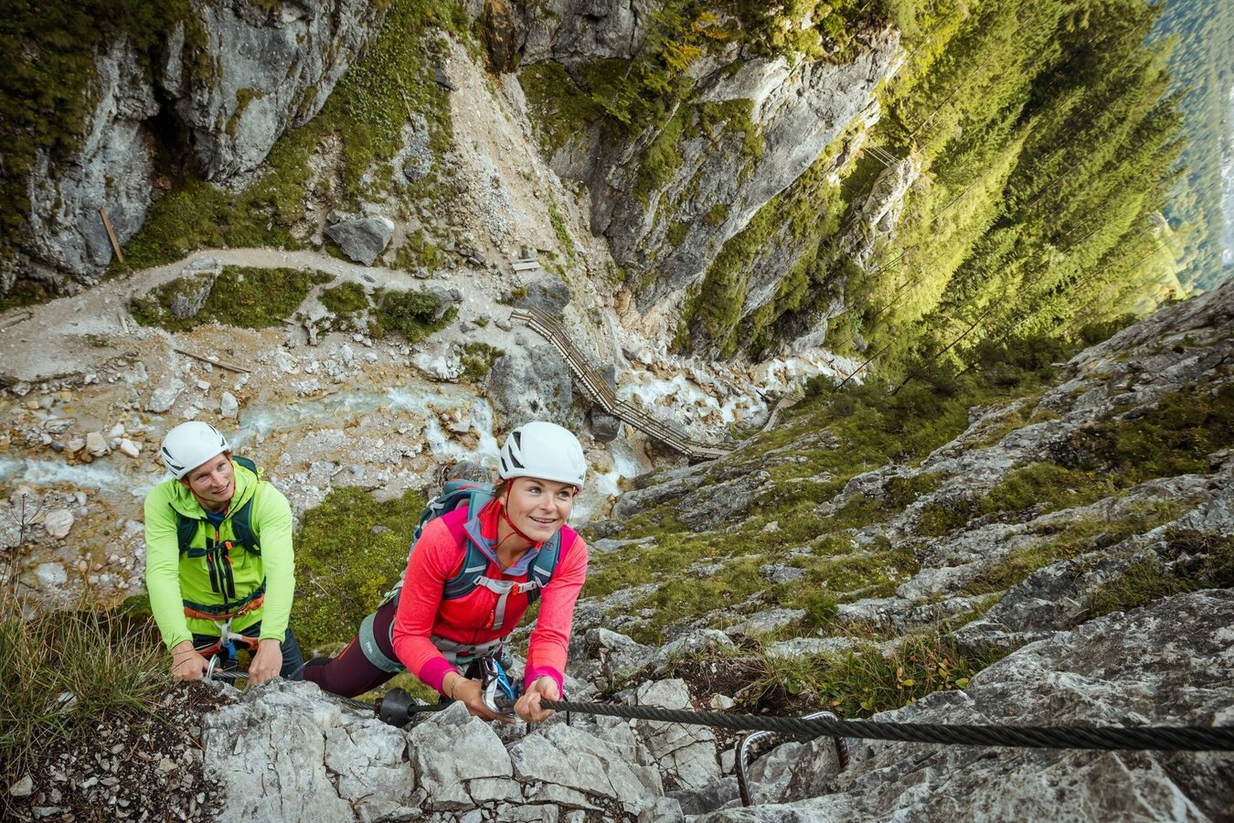
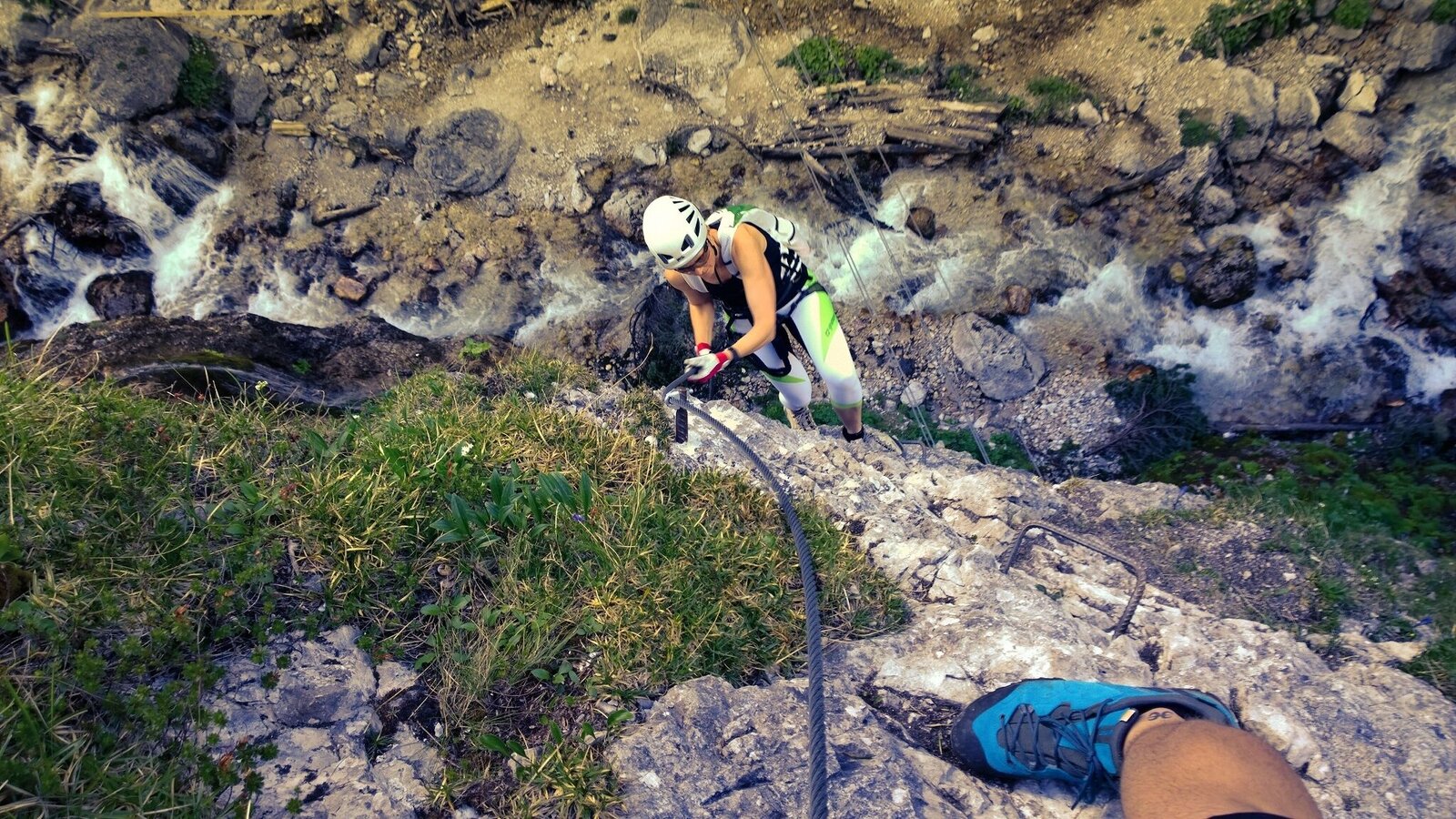
contact
contact
Ramsau am Dachstein

Via Ferrata Rosina

Climbing on the Rosina Klettersteig | © Hans-Peter Steiner
Climbers on the Rosina Klettersteig | © Hans-Peter Steiner
Climbing on the Rosina Klettersteig | © Hans-Peter Steiner

Tour description

The constructor of this protected climbing path, Hans Prugger, has created a vertical masterpiece, which heads straight up – after crossing a rope bridge – from the canyon to the exit.

With no hiking passages or ledges for a break, you need a lot of upper-body strength to get from the entrance to the top. Spend a perfect day out by combining the Via Ferratas: Hias, Siega, and Rosina. A little break at the Silberkarhütte will help to ease away the day’s activities.

Times:

  • Via Ferrata - 1:00 h
  • Time to Base - 0:20 h
  • Time from Top - 0:50 h
  • Total - 2:00 h

The tour

D
publicly accessible
Tour characteristics
Exposition:
Distance: 230 m Climbing time: 45 min
Information
Elevation at the starting point: 940 m
Hiking time to the starting point: 45 min
Elevation at the entrance: 1110 m
Elevation gain on the via ferrata: 130 m
Elevation at the exit: 1240 m
Walking time (descent): 1 h
highest point: 1280 m
Best season
Jan
Feb
Mar
Apr
May
Jun
Jul
Aug
Sep
Oct
Nov
Dec

Map, elevation profile & further information

From the bus stop or the Silberkarklamm parking lot, walk through the gorge (a fee applies!) toward the starting point. After the start of the Hias via ferrata, hike uphill to the next rope bridge. This bridge starts to the right of the trail and leads over the stream into the rock face.
At the exit, follow the path uphill for about 15 minutes until you reach the hiking trail. From there, turn right to the Silberkarhütte and the Siega via ferrata, or turn left to the Fliegenpilz snack bar and the starting point.

The descent via the Silberkar Höhenweg is a challenging forest and root-covered trail with exposed sections. As part of an extensive trail renovation in 2024, the trail was completely renovated, and some existing rope safety devices were removed.

Arriving from the west:From the west you can take the Munich-Salzburg motorway, continuing on the Tauern motorway (A 10) until the Ennstal junction. From here take the Ennstal A-road (the B 320) for around 30 km into the Schladming-Dachstein region, then take the Ramsau am Dachstein turn-off. Then straight ahead 4 km and directly after the bridge turn left and follow "Silberkarklamm" signs.

Arriving from the north:From the south-east take the Pyhrnautobahn motorway (A 9) to the Liezen junction and then the Ennstal A-road (B 320) into the Schladming-Dachstein region. Then take the Ramsau am Dachstein turn-off. Then straight ahead 4 km and directly after the bridge turn left and follow "Silberkarklamm" signs.

Parking lot Silberkarklamm

The starting point can be reached by hiking bus in summer. From the bus stop "Ramsau Silberkarklamm" short walk up to the gorge entrance.

Schedule of the Ramsauer Verkehrsbetriebe

Bus schedules

Wheather predicition

today
23.06.2026
Mountain 12 °C
Valley 26 °C
Precipitation
Probability
60 %
Amount
5.1 l/m²
Wind speed
Nord
10 km / h
Sun
Sun hours
9.8 h
Sunrise
o clock
Sunset
o clock

Possibly sunny spells in the early morning, later heavy clouds with frequent thunderstorms.

tomorrow
24.06.2026
Mountain 12 °C
Valley 27 °C
Precipitation
Probability
45 %
Amount
0 l/m²
Wind speed
Nord
10 km / h
Sun
Sun hours
11.6 h
Sunrise
05:09 o clock
Sunset
21:07 o clock

Dry and bright with plenty of sunshine, clouds will be rare

day after tomorrow
25.06.2026
Mountain 14 °C
Valley 29 °C
Precipitation
Probability
15 %
Amount
0 l/m²
Wind speed
Nordost
10 km / h
Sun
Sun hours
11.2 h
Sunrise
05:10 o clock
Sunset
21:07 o clock

Dry and bright with plenty of sunshine, clouds will be rare

Tours nearby